
Guide to Hiking in Yosemite National Park
Discover the Majesty of Yosemite
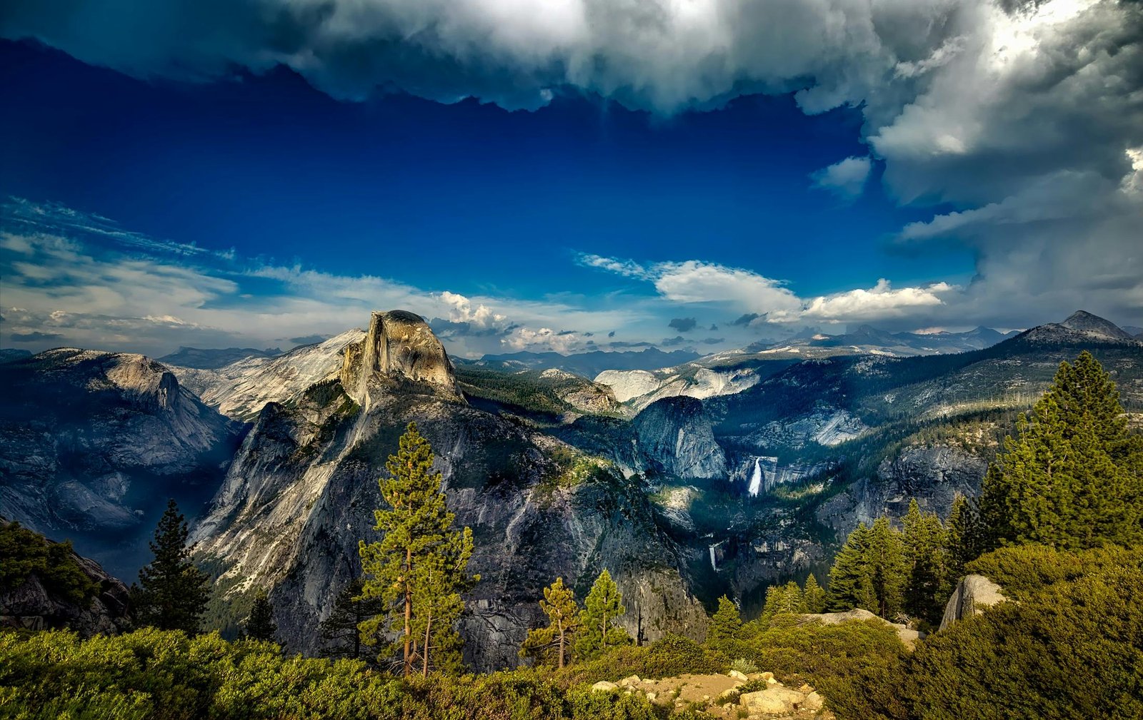
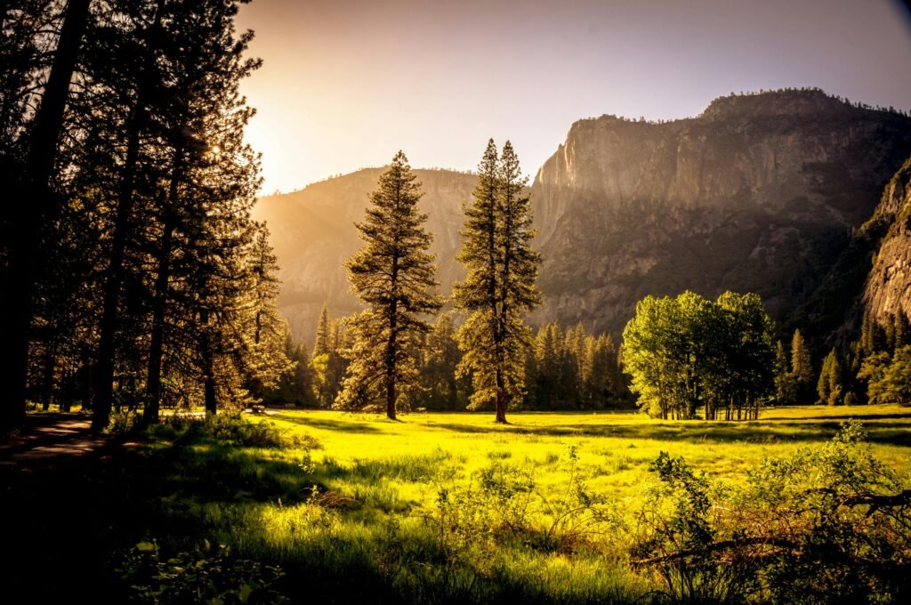
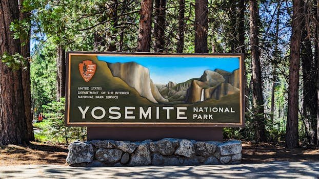
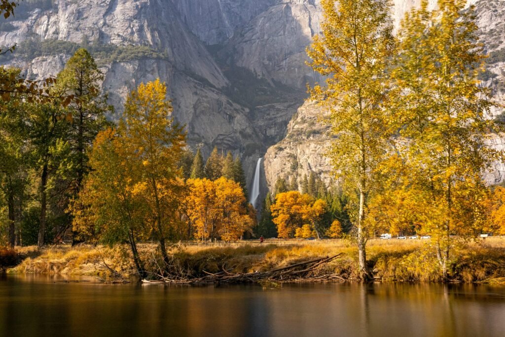
Yosemite National Park is one of the most breathtaking destinations in the United States. Located in California’s Sierra Nevada Mountains, this UNESCO World Heritage Site is famous for its towering granite cliffs, majestic waterfalls, and lush forests. Whether you’re a seasoned hiker or a beginner, Yosemite offers a variety of trails that cater to all levels. Enjoy this guide to hiking in Yosemite.
What Makes Yosemite So Special?
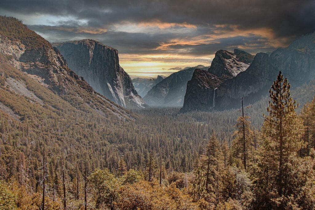
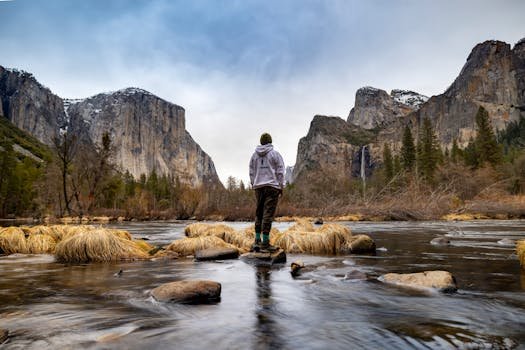
Yosemite is renowned for its unparalleled natural beauty, diverse ecosystems, and rich history. It is home to some of the most iconic landscapes in the world, including El Capitan, Half Dome, and Yosemite Falls. The park’s unique combination of massive granite formations, lush valleys, and high-altitude meadows makes it a must-visit destination for nature lovers and adventure seekers alike.
Why is Yosemite Special for Hikers?
- Variety of Trails: From easy scenic walks to challenging summit hikes, Yosemite caters to all skill levels.
- Breathtaking Scenery: Trails offer views of towering cliffs, roaring waterfalls, and pristine alpine lakes.
- Rich Biodiversity: Encounter a diverse range of wildlife, from black bears to mule deer.
- Adventure and Challenge: Iconic hikes like Half Dome provide thrill-seekers with the ultimate trekking experience.
- Historic and Geological Significance: Hiking through Yosemite is a journey through millions of years of geological evolution.
How to Reach Yosemite National Park
Yosemite is accessible by car, bus, and even air travel. The closest major airports are Fresno Yosemite International Airport (FAT) and San Francisco International Airport (SFO). From these airports, you can rent a car or take a shuttle service to the park. If you’re driving, major highways like Highway 120, Highway 140, and Highway 41 provide access to Yosemite Valley.
Yosemite’s Four Park Entrances
Yosemite National Park has four main entrances, each offering unique access points and scenic routes:
- Big Oak Flat Entrance (Highway 120 West): The fastest route from San Francisco and the Bay Area, offering access to Yosemite Valley and key attractions.
- Tioga Pass Entrance (Highway 120 East): A seasonal entrance open in summer, offering breathtaking views and access to Tuolumne Meadows and the High Sierra.
- Arch Rock Entrance (Highway 140): Known for its lower elevation and year-round accessibility, making it a good choice during winter months.
- South Entrance (Highway 41): The best route for visitors coming from Fresno, leading directly to the Mariposa Grove of Giant Sequoias.
Best Hiking Trails in Yosemite
1. Yosemite Falls Trail (Strenuous)
- Distance: 7.2 miles round trip
- Elevation Gain: 2,700 feet
- Recommendations: Start early to avoid crowds and bring plenty of water.
- Difficulty: Hard
- Tips: Offers breathtaking views of one of the tallest waterfalls in North America.
2. Glacier Point Trail (Moderate)
- Distance: 4 miles round trip
- Elevation Gain: 900 feet
- Recommendations: Ideal for families and those wanting a shorter, scenic hike.
- Difficulty: Moderate
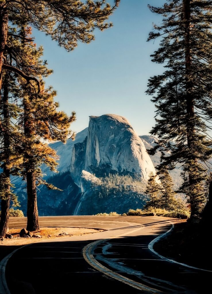
- Tips: Provides panoramic views of Half Dome and Yosemite Valley.
3. Mist Trail to Vernal and Nevada Falls (Moderate to Strenuous)
- Distance: 7 miles round trip
- Elevation Gain: 2,000 feet
- Recommendations: Prepare for steep, misty steps and wear waterproof gear.
- Difficulty: Moderate to Hard
- Tips: One of the most scenic waterfall hikes in Yosemite.
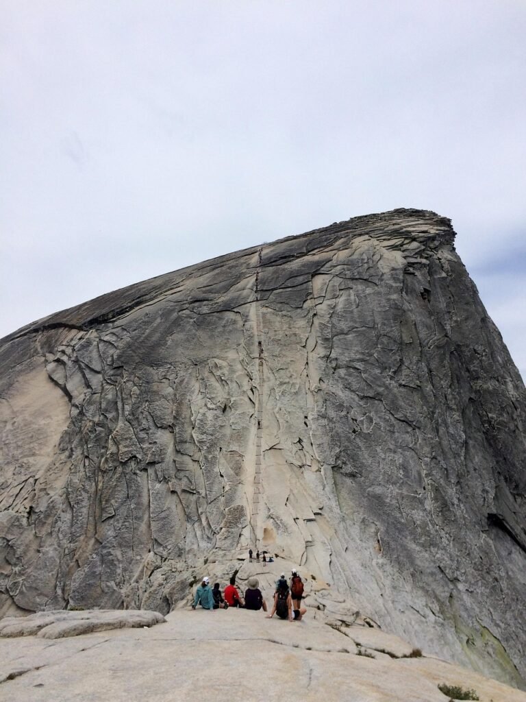
4. Half Dome Trail (Very Strenuous – Permit Required)
- Distance: 14-16 miles round trip
- Elevation Gain: 4,800 feet
- Recommendations: Requires advance permit; bring gloves for the cable ascent.
- Difficulty: Extremely Hard
- Tips: Only for experienced hikers; best done in summer months.
5. Mariposa Grove Trail (Easy to Moderate)
- Distance: 2-7 miles depending on the route
- Recommendations: Best for seeing Giant Sequoias up close.
- Difficulty: Easy to Moderate
- Tips: Visit early to experience the tranquility of the ancient trees.
Essential Gear Recommendations
- Footwear: Sturdy hiking boots with ankle support. How to Choose the Perfect Hiking Boots – Trail Seeker
- Clothing: Layered moisture-wicking attire and waterproof outerwear.
- Navigation Tools: Map, compass, or GPS device.
- Hydration: Sufficient water supply or a portable water filter. At least 2-3 liters of water per person.
- Safety Items: First-aid kit, whistle, flashlight, and multi-tool.
- Food: High-energy snacks and meals.
- Sun Protection: Sunscreen, sunglasses, and a wide-brimmed hat.
- Additional Items: Trekking poles and bear-proof food storage containers.
Trail and Safety Precautions
- Stay on Marked Trails: Venturing off-trail can be dangerous and harmful to the environment.
- Inform Others of Your Plans: Let someone know your itinerary and expected return time.
- Check Weather Conditions: Weather can change rapidly; always be prepared.
- Carry Adequate Supplies: Bring enough water, food, and emergency gear.
- Wildlife Awareness: Keep a safe distance and never feed animals.
Trail Conditions: Before setting out, always check current trail conditions, as some paths may be closed due to maintenance or natural events. The National Park Service provides up-to-date information on trail statuses.
nps.gov
Safety Precautions: Given recent staffing challenges, it’s crucial to prioritize safety. Ensure you’re well-prepared for hikes, stay on marked trails, and inform someone about your itinerary. For detailed safety guidelines, refer to the park’s official resources.
nps.gov
Road Closures: Seasonal closures, especially Tioga Road and Glacier Point Road, typically occur from late fall to late spring.
Where to Find Trail Yosemite Maps
Having a reliable trail map is essential for navigating Yosemite’s vast network of trails. Here are the best places to find accurate maps:
Official National Park Service Website (nps.gov) – Offers downloadable maps of hiking trails, campgrounds, and key attractions.
Yosemite Visitor Centers – Stop by the Yosemite Valley Visitor Center, Wawona Visitor Center, or Tuolumne Meadows Visitor Center for free paper maps and expert advice.
Yosemite Conservancy Bookstore – Sells detailed topographic maps, guidebooks, and waterproof maps ideal for hikers.
Mobile Apps – Apps like AllTrails and Gaia GPS provide real-time trail maps, GPS tracking, and elevation data.
Ranger Stations – Park rangers at designated stations can provide updated trail conditions and recommendations.
Weather and Trail Conditions
- Spring (April – June): Best time to see waterfalls; some trails may be snow-covered.
- Summer (July – September): Most trails are open, but temperatures can be high.
- Fall (October – November): Cooler weather and fewer crowds make it a great time for hiking.
- Winter (December – March): Snow-covered trails require special gear and may be closed.
Reservation System Updates
As of February 2025, Yosemite National Park has implemented a reservation system to manage visitor access during peak periods. Reservations are required to enter the park between 6 am and 4 pm from May 20 through September 30, 2025. This system aims to reduce overcrowding and preserve the park’s natural resources. To secure your spot, make reservations in advance through the official National Park Service website (nps.gov).
Is hiring a tour guide in Yosemite worth it?
Many visitors opt for guided tours to enhance their Yosemite experience. Here’s what to consider:
Advantages of Paid Tours
Expert Guidance: Gain insights into the park’s history, wildlife, and geology from experienced guides.
Convenience: No need to worry about navigation or permits; everything is arranged for you.
Safety: Guides ensure you stay on the right trails and follow park regulations.
Exclusive Access: Some tours offer access to areas that are otherwise difficult to reach.
Disadvantages of Paid Tours
Cost: Tours can be expensive, especially private or specialized ones.
Fixed Schedules: Less flexibility to explore at your own pace.
Group Size: Some tours may be crowded, affecting the experience.
Popular tour options include guided hikes, photography tours, and sightseeing bus tours. For more information, check with the official park website or local tour operators.
Additional Resources
For comprehensive trip planning, including lodging options, activity suggestions, and travel tips, the Yosemite Mariposa County Tourism Bureau offers valuable insights.
yosemite.com
By staying informed and planning ahead, you can ensure a memorable and safe hiking experience in Yosemite National Park
Conclusion
Yosemite National Park is a hiker’s paradise with diverse trails that showcase its stunning landscapes. Whether you’re embarking on an easy nature walk or tackling the challenging Half Dome, Yosemite promises an unforgettable outdoor adventure. Plan your trip wisely, follow safety guidelines, and immerse yourself in one of the most iconic national parks in the world!